
This hike is scheduled for September 14, 2013.
Pam Bliss and Scott Lake joined a Senior Center Hike to El Malpais NM Sandstone Bluffs. The Hike was approximately 6 miles round trip along the bluffs going north from Sandstone Bluffs Road parking area. The day was comfortably warm and the sites were picturesque. The sandstone arch was quite a surprise. The walk was long but fairly easy. Very little climbing or elevation gain. Well worth the effort.
Below is a description from the Senior Center website. There is a map of the area here. The green area is the lava field.
Actual Hike The hike starts at the parking spot. Just west of parking are good views of the bluffs, the El Malpais lava flow, and Gallo Mountain on the west side of the flow. Beyond are the Zuni Mountains. Start the hike by going north along the cliff top. Mount Taylor will be clearly visible to the north. This portion of the hike is about 1.3 miles, with many sandstone formations along the way. On reaching a downed barbed wire fence there is a drop off into the EASY WAY, the easy way to the bottom below the cliffs. Since this description is for a counterclockwise hike the hike continues on top of the ridge. There will be ups and downs as the route continues north. At 2.6 miles from the start there will be a rocky prominence to the west. Near the edge is the top of one of the larger arches in the area. To shorten the hike there is a steep way down is just north of this arch opening. Traverse back and forth to make the descent easier. Otherwise continue north along the top and find a way down to the floor. Do not go further than the [END] (2.3 mi) since the way will be pinched down by the lava flow. Once down turn back south and find a large rock surface with [INSCRIPTIONS] (2.8 mi) on it. This is a good stop for lunch if shade is desired. Then go back east and go north through a notch, passing the “foot”. It will be easier to see it as a foot after passing through the notch and looking back north. Look for the arch above at this point. After about 0.2 miles is the entrance to [HIDDEN VALLEY] (3.1 mi). It is possible to go up this notch to the top of one of the other arches, but continuing north would be difficult. Return to the entrance after going as far as desired. Continue along the base of the cliffs and to the [EASY WAY] (3.7 mi). If this is missed, there will not be another easy way further south. Once back on top, retrace the route to parking.
-
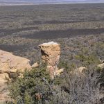
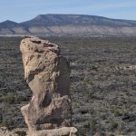
- One of the many pillar like sandstone structures
-
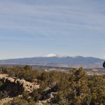
- Mt. Taylor
-
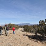
- The Senior hikers
-
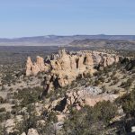
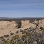
- More of the many sandstone structures
-
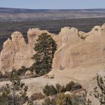
- More of the many sandstone structures
-
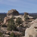
- More of the many sandstone structures and a Ponderosa Pine
-
- More of the many sandstone structures
-
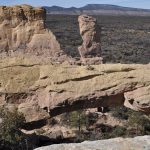
- More of the many sandstone structures with the sandstone arch in the foreground
-
- More of the many sandstone structures
-
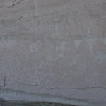
- Petroglyhs near the sandstone arch
-
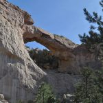
- Sandstone arch which is fairly large seen from below the bluffs